Tuesday, March 22, 2005

Welcome!

Welcome to my blog on the trip my dad and I took to the Mojave Desert and Death Valley on March 16th and 17th 2005. I put this blog together as a way to share the pictures.

The pictures have been posted in organization of feature, and start from the first we saw, ending at the last we saw. Thus, you will be taking our trip in reverse. Please enjoy the pictures and write up, and feel free to comment on anything. If any of my information is incorrect, don't hesitate to let me know.

Thanks for visiting.

Leaving Death Valley

Some pictures from the end of our trip as we finished making out way through Death Valley (at least the southern half) and started on our way out.


"Sand Dunes" was the name applied to these splendid dunes outside of Stovepipe Wells


The small town of Stovepipe Wells, still well inside Death Valley


No more than a minute after taking this picture, someone actually fed the crows. I am completely serious.


No, we are not in Germany, this sign was hanging at the gas station in Stovepipe Wells.


The long road out


The setting sun and the damage done.


The Panamint Mountians as viewed from the Panamint Valley


Our last view of the Panamints

Saturday, March 19, 2005

Golden Canyon

This was our main event for the trip. We wanted to hike to the top of Zabrinski Point, but that trail was closed due to flood damage. We stopped at Golden Canyon instead. It was stunning. The hike through Golden Canyon was very easy too, perfect for any member of the family (we even saw a woman with a wheel chair up there).


When you start the hike, there is a bunch of conglomerate around you, this is typical of alluvial fans. Rocks get left in the fan along with sand and get buried by new sediment. The pressure of the material above cements the rocks with the sand, creating this new sedimentary rock.


The conglomerate rock gives way to smooth sandstone and red rock, much of it coated in a soft green clay. This is common of lakebeds. Here, we can see ripples of ancient waves against the long gone shore. These ripples have been frozen in time from the clay that coated the rock.


Why is it so vertical, though? Faulting took the once smooth lake bottom/shore and thrust the rocks up at an angle. Now it is hard to believe this used to be a tepid lake.


As you get near the end of the hike, the red mountains loom off in the distance. I was unable to find much information on these rocks.


They are probably volcanic

At this point you can continue another quarter mile to the Red Cathedral, or if you want a challenging (and even more beautiful) hike, opt for the Golver's Gulch/Zabrinski Point hike that goes off to the right.


Our now narrow trail winding up the face of Manly Beacon (?)

The view from the side of Manly Beacon, and other high points of the trail were the high lights of our trip, at least for me.


The view to the right (when turned around on the trail)


looking straight back (note the people in the second picture)


Further down the trail, past Manly Beacon, looking to the left.

And then we descended into Golver's Gulch. the Gulch is subject to many flash floods, especially since 1941 when they diverted Furnace Creek for its water, preventing the Creek from sharing in the load of water after heavy rains. Now, this once calm flow turns into something comparable to the Colorado River through the Grand Canyon after a heavy rain. After heavy rains, the river flows right over 190, causing quite a mess for Park Personnel. They should probably fix that.


Into the gulch


The rocks here were stunning, sometimes the sides were so steep


looking back behind us about 1/2 a mile from leaving the gulch.

I stopped taking pictures soon after, missed where the gulch lead into the valley, and the 15 foot dry water fall that brings it there (that we almost walked over because the trail wasn't clear). But all and all, not a bad day. We hiked for two hours, then hastily went to the Furnace Creek Ranch for lunch.

Badwater

Death Valley used to be a large lake, existing until about 10,500 years ago. The lake, named Lake Manly, was an estimated 2000 ft deep. The lake resurges every couple thousand years, but never at its deep peak. The rains brought back some of the water at Badwater, the lowest place in the US at 282 ft below sea water.

What makes this depth even more dramatic is the steep rise of the Panamint Mountains and Sierra Nevadas to the west. We peaked at almost 5,000 feet when leaving the valley through the Panamints. Mt. Whitney in the background is roughly 14,500 ft high.

The salt [white in foreground of first picture] is the bed of the ancient lake, all that was left after the water evaporated.


Friday, March 18, 2005

Death Valley Wildflowers!

After the night in Baker, we headed north into Death Valley. We weren't alone, the valley was packed. Everyone with a camera was out in the valley taking pictures of the flowers, and other wonderful valley features.

With the 30+ inches or rain we got this winter, the wildflowers this season in Death Valley are insane! The best bloom of the century, they are saying. I suggest everyone take a weekend, and spend it in Death Valley this spring (get there before May). Even if you miss the flowers, the scenery in Death Valley is breath taking, even when barren.

But it wasn't barren when we there.


The first valley we saw dusted with flowers [desert gold]


desert gold with desert chicory


close up of the desert gold


close up of the desert chicory


desert chicory has a very weak stem, so it usually supports itself with other plants in this case desert sage (I am not 100% sure of this)


close up of the desert sage


The only scarlet locoweed we saw, a VERY rare plant for Death Valley

Last but not least, fields of desert gold with the Sierra Nevadas in the background


Miscellaneous from the Mojave

Just some random pictures from the trip that we took in between the main events.


This is why free enterprise is such a wonderful thing. Welcome to Fenner, CA. This isn't a part of the town of Fenner, this is Fenner. That's right, Fenner is a gas station 35 miles away from any other gas station. oh, and the trailers for the employees of the gas station. There was also food at the gas station.


Butterfly carnage. We probably killed 200 of these in the Mojave. Bugs need to look both ways.

After driving through the Mojave we stopped in Baker CA, "The Gateway to Death Valley". That name hasn't helped Baker much. These pictures are dedicated to Baker.


I know, looks charming on the outside, huh? With that authentic Hawaiian roof line. Trying to make it appear to be an oasis in the desert. But this is where the charm ends.


And the Hawaiian theme doesn't end with the front office. No! It just keeps going, and going, and going...

Being a luxurious hotel in the middle of an oasis, Arne's Royal Hawaiian came with many amenities:


serene waterfalls, typical of an oasis (this is as far as the shower would turn off)


Wildlife


Any for entertainment, we have a pool with a lovely hut and view of an abandoned concrete mill/junk yard


And what is a fine hotel without a television complete with no channels. Forget pay-perview, this thing wouldn't show any picture. I am proud to report that the sound was fine, however.

Oh, and most of the lights didn't work either. In summery: you would camp over this.

What the flip was Lauren doing at the (Kelso) dunes!?

Not four wheelin' that's for sure. All off road activity was prohibited at the dunes, I guess they are protecting the uh... lizards. In any case, from Mitchell's Caverns we went back west on the 40 to Kelbaker road, the same road that brought us out of the route 66/crater area. A bit round-a-bout, but there aren't many through roads in the Mojave.

The dunes were big. Estimates are that the sand is 700 feed deep! That's a lot to sink into! From the parking lot, we hiked maybe a 1/2 mile in the sand, up and down sort-of dunes before deciding to turn around. We wanted to see the cinder cone field in the north Mojave, and honestly, it was just too much sand.

Kelso Dunes are still neat, even if you don't feel like hiking up hills in sand for a few miles. The stretch of dunes is 35 miles long. Winds from the Granite Mountains [to the south west] feed the dunes both in sand (from alluvial fans) and winds. Well, what makes the sand stay there? Wind currents hitting against the Providence Mountains to the east move the sand up and back west, keeping the dunes basically where they are. That doesn't mean they don't "move" though. Wind is constantly changing and reshaping the dunes.

Besides being quite long, Kelso Dunes are also a very special kind of dune because they boom. Only 30 dunes around the world are known to do this. During a strong wind, the moving sand rubbing up against the stationary sand on the lee side of the dune (the flat side) makes a low-pitched boom, described as the sound of a low flying aircraft. We were not fortunate enough to hear the sand boom, then again, we were fortunate enough not to be caught in the sand storm needed for the dunes to boom.


Dad taking pictures of the Providence Mountains (Mitchell Caverns are in these mountains)


Sand, and more sand. Lots of sand, and lots of critter marks in the sand


More sand

Mitchell Caverns

Our next stop was Mitchell Caverns. Mitchell Caverns are within the boundary of the Mojave National Park. They are further down the 40 than Pisgah crater and within Park boundaries. They give tours at 1:30 on Weekdays, and three times a day on weekends. There were actually 15-20 people with us on the Wednesday we went, we were quite surprised at the turn out.

The caverns were most likely formed under the water table, where ground water trickled down through cracks in the limestone. When rainwater mixes with ground water it becomes undersaturated with calcite. The carbon dioxide in the water is lightly acidic to the limestone. The water dissolves a little of the limestone, mixing it with the calcite in the water. Then, when the water drips off the ceiling of the cave, it leaves behind a little ring of this solution.

Drip after drip the water falls, leaving a hollow hole in the middle of the stalactite it is forming. When this hole becomes plugged up, the water will drip down the outside, creating the classic icicle stalactite we all know. When the water hits the limestone floor, it begins to build stalagmites. When a stalactite and stalagmite meets, they form a column. Over time, the inside of the limestone formation is dissolved away into caves adorned with these formations.


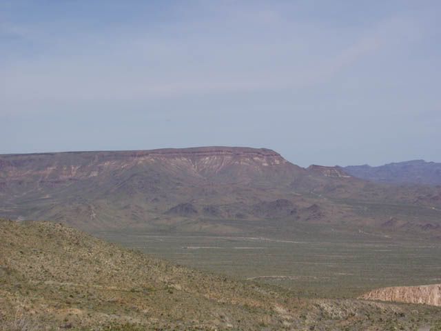
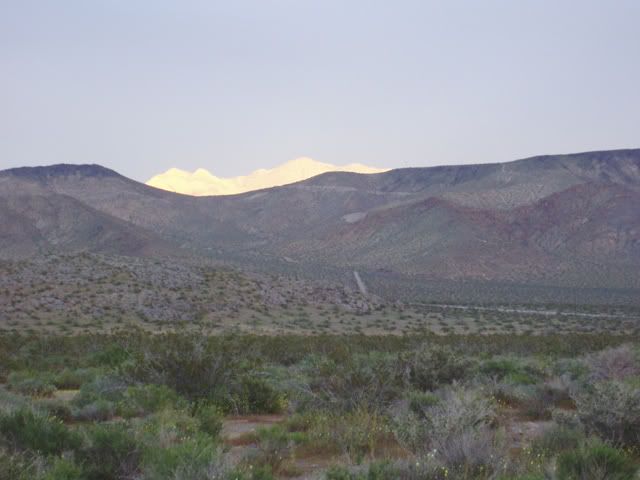
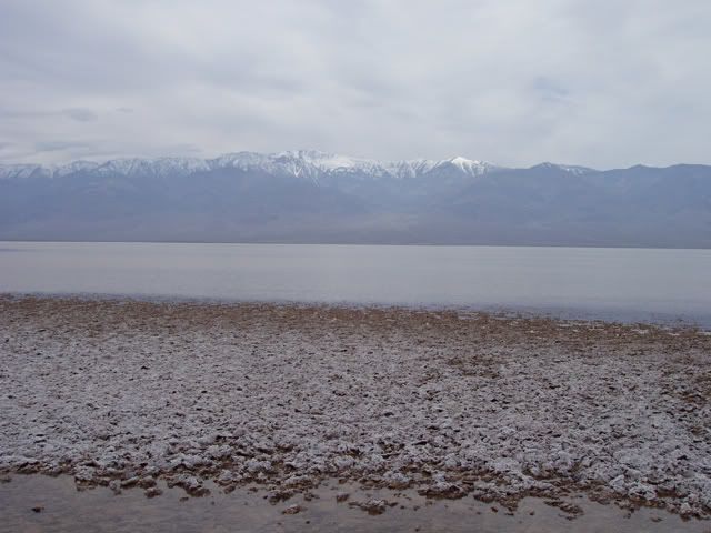
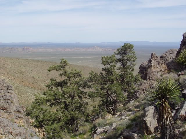
This is the view from outside of Mitchell Caverns looking out over the valley. The flat mountain in the left center is Wildhorse Mesa. Wildhorse Mesa started as valleys and small hills. A violent volcanic eruption 15 miles away millions of years ago incased the valleys and hills in ash. The ash was more resistant to erosion than the surrounding, higher countryside. The surrounding area eroded away leaving the once low area as the predominate feature. I also assume Wildhorse Mesa could have had some help in growing with push up from volcanic or fault activity.


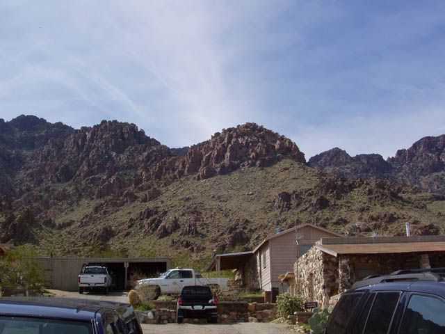
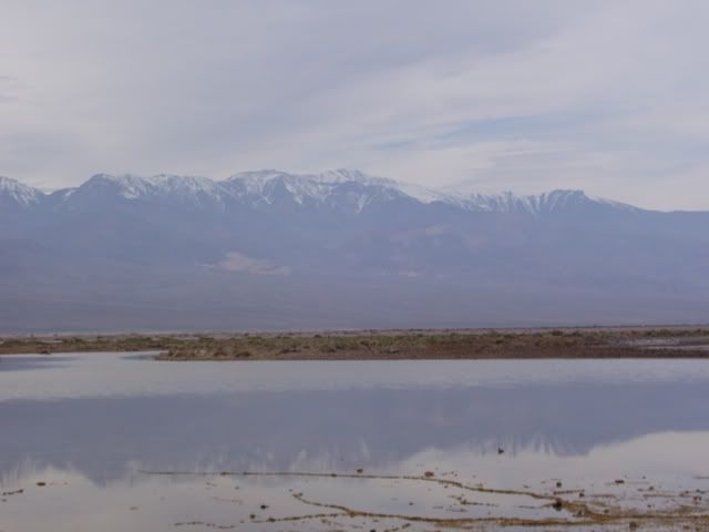
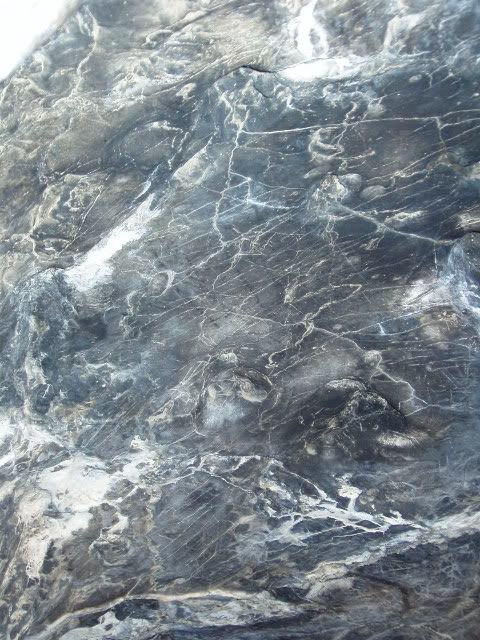
Turning around 180 from Wildhorse Mesa, these are the mountains that house the caves. The red rocks are made of ryolite, a magma as violent as basalt is fluid. The gray rock is what is left of the softer limestone. Most of it has eroded away from the ryolite.


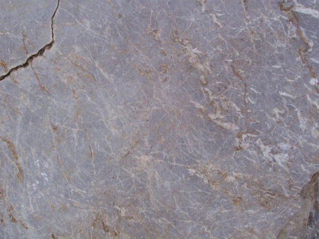
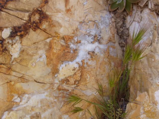
We start our hike. Along side the wall is limestone intruded with quartz (white veins) and chert (orange). Both of these entered into the limestone when it was underground, much lower than its current 4,300 foot elevation.


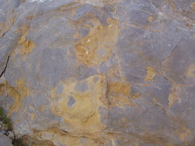
Chert is a sedimentary rock made from decomposed ocean creatures, like sea sponge. It is much harder than the limestone around it, thus it stands out in relief from the limestone. These rocks are about 300 million years old.


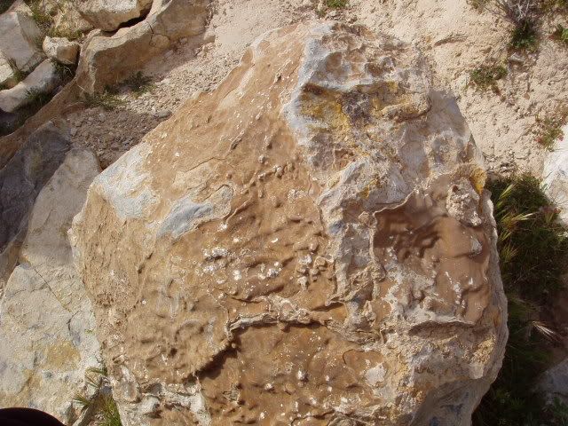
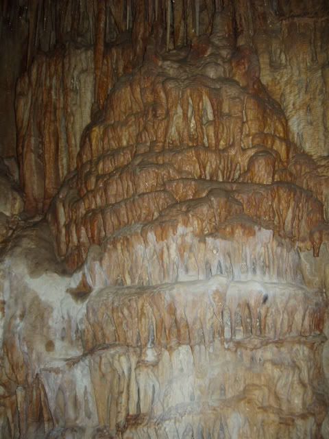
The brown flowing stone that is on top of this limestone is aptly called flowstone, it is formed from the limestone and water that flows over the rocks.


Another picture of our view


this piece of limestone had a lot of quartz in it.


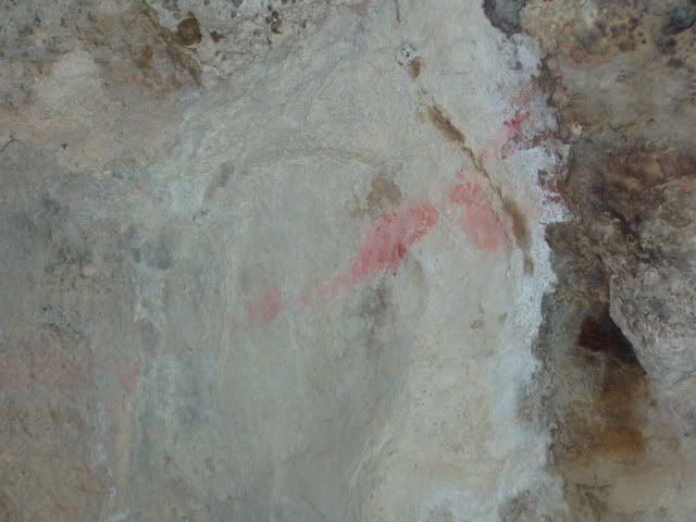
Entering the cave the ceiling was scared from fire, both from Native Americans and the “founder” of the caverns, Jack Mitchell in the 1930s. On the right wall we saw these markings. Perhaps drawn by the Native Americans.
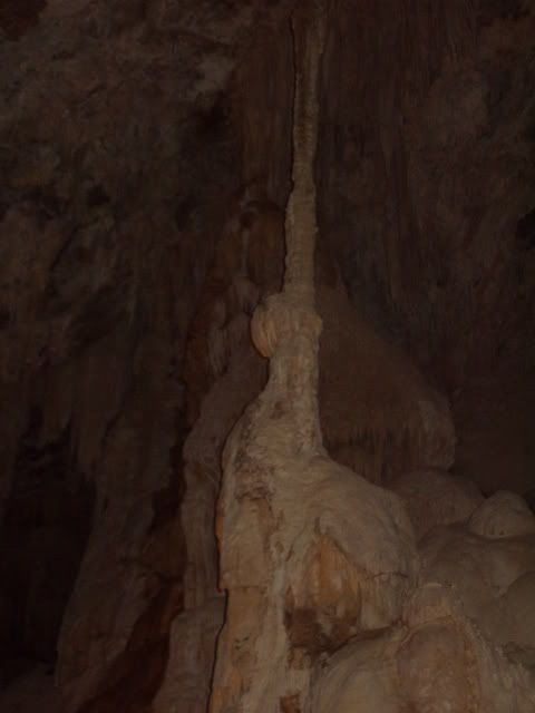

A column


Behind this column you will see a flat disk connected to the wall. This is called a shield, and is very rare. They occur when there is pressure preventing the intruding water from dripping downwards, so instead it spreads out in a circular pattern.


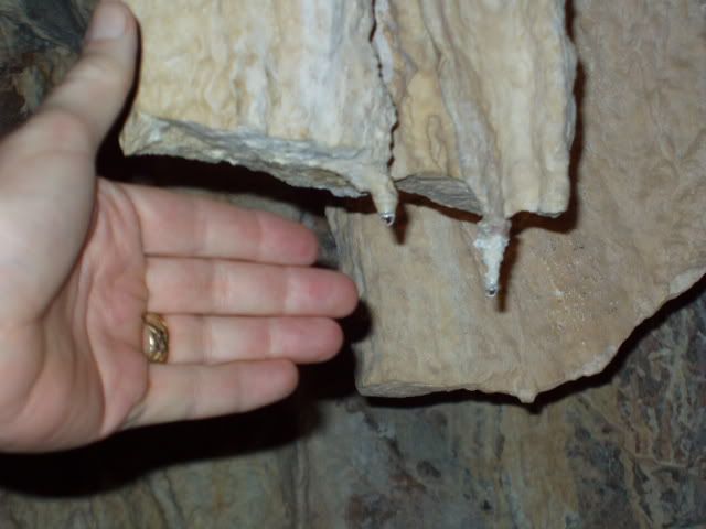
And they are still growing! The last rains we had did a lot more than just wet the walls. The little one attached to the larger broken off one is 50 years old. If it took 50 years for this stalactite to grow one inch, imagine how old the other ones are (hand for scale).
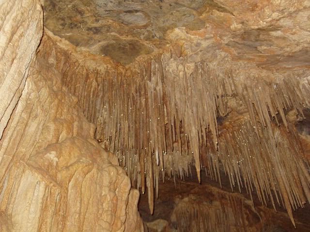

looking up


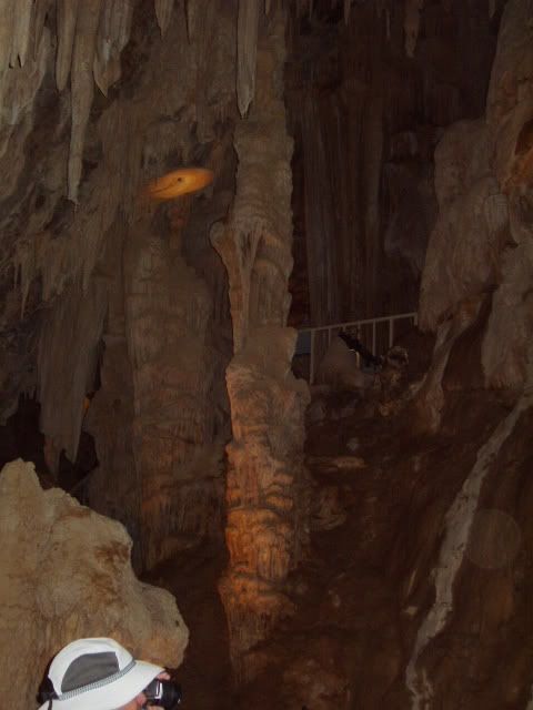
A cool column with many rows of stalactites on it.


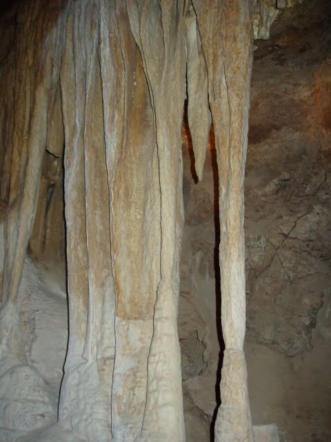
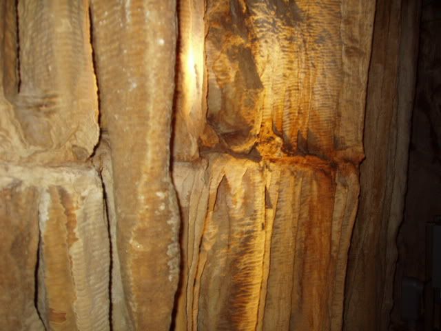
some ribbon like columns.


This break was probably caused by an earthquake. Look how the stalactites repair themselves. There was another fracture about two feet above this one.


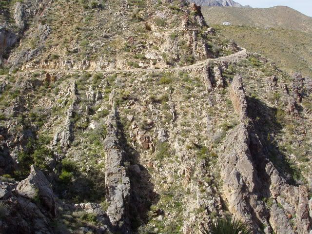
Back outside. Those vertical spines of rock are the limestone, this is how it is being eroded away on this face.


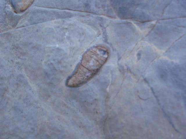
After looking very hard, we found fossils. This little guy is a fusulinid, a one celled floating creature from the Pennsylvanian or Permian age.
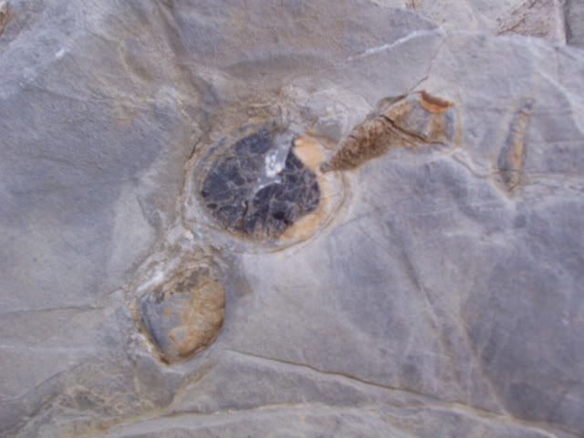
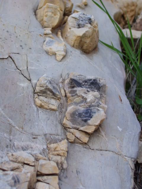

More fossils


Quartz crystals coming up out of the limestone.


A large vain of quartz


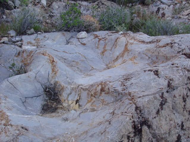
speaking of erosion… water falling onto this rock caused the smooth depressions.

That as it for the caverns. We opted to skip the gift store and get back on the road, there were more wonders to be seen before night fall.